

Geospatial Operations
See Every Vehicle and Zone Boundary at a Glance
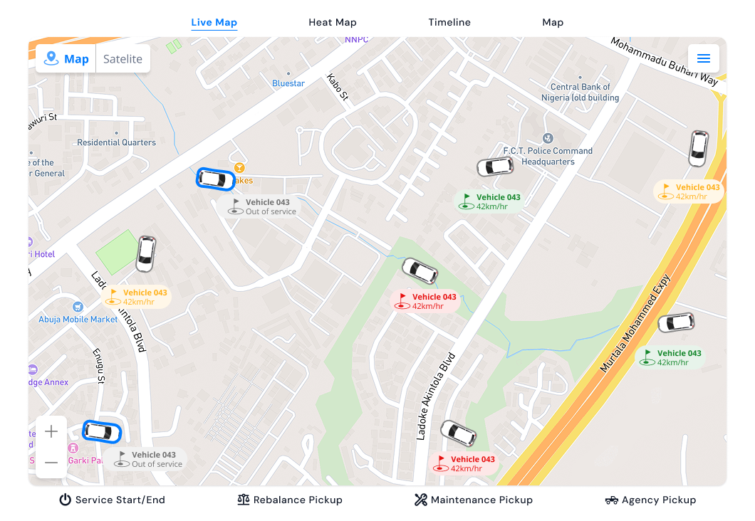
Monitor fleet distribution, spot rebalancing opportunities, and verify geofence enforcement from a unified map canvas.
Live Tracking
Live Vehicle Pins & Clustering
Track every scooter, e-bike, and EV with instant status indicators for available, in-ride, low-battery, and offline.
Zone Layers
Geofence Layer Overlays
Toggle service areas, slow-speed zones, no-go zones, and parking bays directly on the operational map.
Map Settings
Map Appearance & Provider Settings
Configure default map center coordinates, zoom levels, and zone styling preferences per organization.
Rebalancing
Rebalancing & Heatmap Readiness
Identify high-demand corridors and stranded vehicles quickly to optimize field crew routing.
Geospatial Command in Three Steps
1. Inspect Fleet Density
Open the live map to view active vehicle clusters and battery levels.
2. Overlay Zone Rules
Verify parking hubs, speed limits, and restricted boundaries visually.
3. Dispatch Field Ops
Direct technicians to low-battery or out-of-zone vehicles immediately.